point in the survey to provide the directional control needed in the survey network. The observation of
the longitude and azimuth is frequently repeated in the survey to give control to the geodetic network.
When combined with other geodetic measurements, astronomic observations provide a method for
determining the deflection of the vertical. This can help in determining the figure of the earth. Places at
which astronomic longitude and azimuth are measured are called Laplace stations.
c. When making astronomic observations with an optical instrument containing a leveling device,
the vertical axis of the instrument is perpendicular to the geoid. This means that the axis coincides with
the direction of the force of gravity or a plumb line at the observation site. Therefore, an astronomic
observation gives a direction with respect to the geoid.
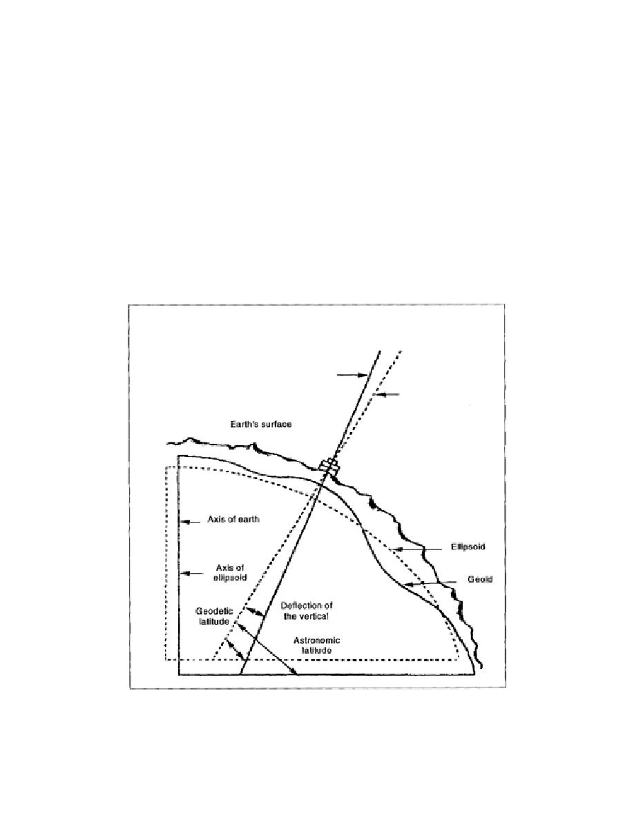
d. The normal to the ellipsoid defines geodetic latitude and longitude. Since the direction of gravity
rarely coincides with the normal of the ellipsoid, astronomic coordinates do not represent positions on
the ellipsoid (Figure 1-6). This difference, the deflection of the vertical, can be used to help determine
the accuracy of the survey technique and the suitability of the ellipsoid for use in a particular surveyed
area.
Figure 1-6. Deflection of the Vertical
1-9
EN0593


 Previous Page
