made. After combining the data with information obtained from star catalogues, the position is
computed.
a. While geodesists use elaborate and very precise techniques for determining astronomic latitude,
the simplest method is to measure the angle between the Polaris and the horizon of the observer.
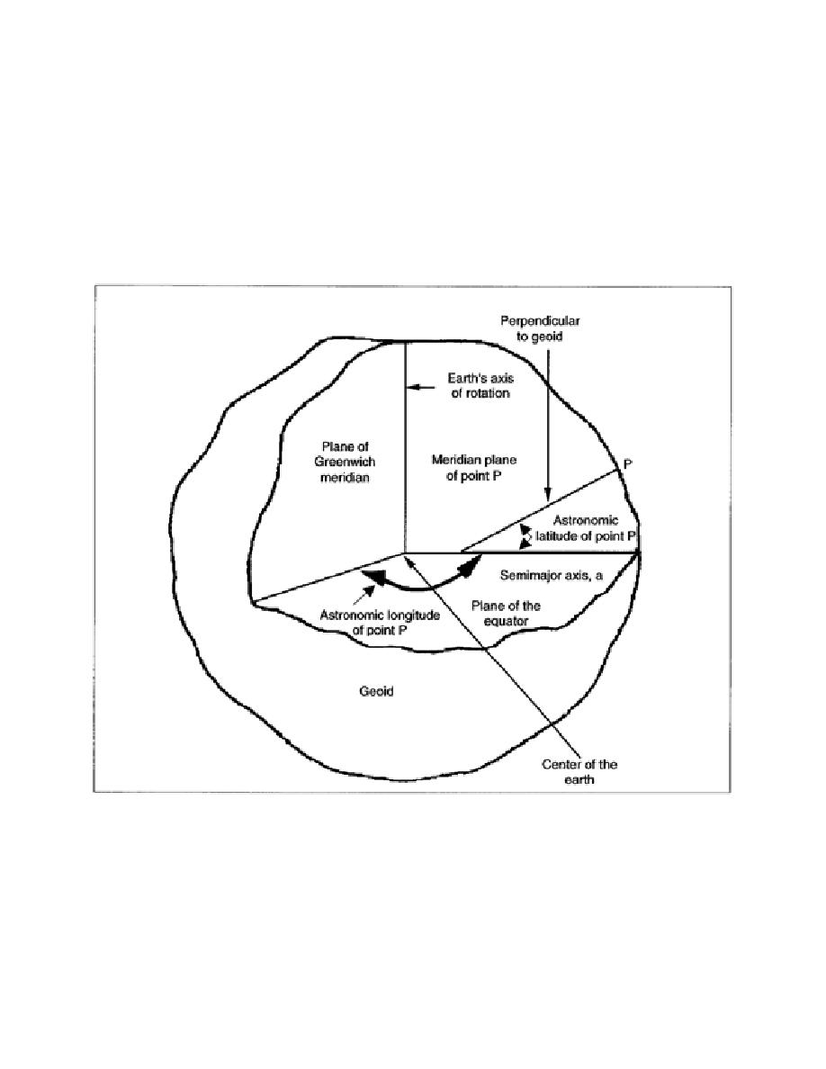
Astronomic latitude is defined as the elevation of the Polaris above the horizon, or the angle between the
perpendicular to the geoid at point P and the plane of the equator (semimajor axis). The angle of
elevation of the Polaris is about equal to the astronomic latitude. The astronomic longitude shown in
Figure 1-5 is the angle between the plane of the Greenwich meridian (prime meridian) and the
astronomic meridian of the point.
Figure 1-5. Astronomic Coordinates
b. It is necessary to always reference a system of horizontal measurements with respect to the earth,
with the exception of surveys with very limited scope, such as engineering plans or city surveys. To
obtain this reference, make astronomic observations to obtain astronomic coordinates for points on the
earth's surface. You will observe the astronomic latitude and longitude at a starting point known as the
origin of the survey. You should also determine an azimuth or directional control to another
EN0593
1-8


 Previous Page
