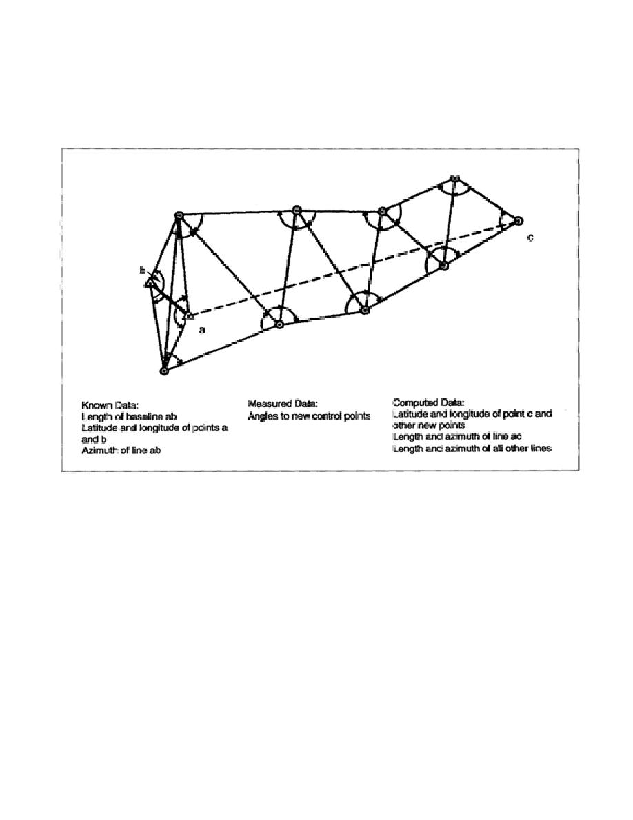
(2) To establish an arc of triangulation between two widely separated locations, you must
measure a baseline at each location, connect these measured areas by a series of adjoining triangles
forming quadrilaterals, and compute the latitude and longitude for the vertex of each triangle. The
vertex is then called a triangulation or geodetic-control station. The end of the baseline is often called
the initial point, and the directions of the sides of the triangles are called azimuths (Figure 1-9).
Figure 1-9. Simple Triangulation Net - Example 1
(3) Triangulation may be extended to cover larger areas by connecting and extending a series of
arcs that form a network. The network, which forms the triangulation system, is mathematically
adjusted to reduce all errors to a minimum.
c. Trilateration. Recently, electronic and light wave distance-measuring equipment has been
applied to geodetic surveys in a technique known as trilateration. Trilateration is the measurement of
the sides of a triangle. Each side of the triangular net is measured repeatedly to ensure precision. The
angles of the triangle and geodetic positions are computed, as in triangulation (Figure 1-10, page 1-14).
These systems also permit surveying over large water barriers, allowing the connection of islands and
continents. Traditional electronic systems only measure distance.
1-13
EN0593


 Previous Page
