rounding the area.) All distances indicated in a plan
2-4.
ELEVATIONS
view simply express a horizontal measurement
between two points and do not take into
consideration terrain irregularities. Sizes of proposed
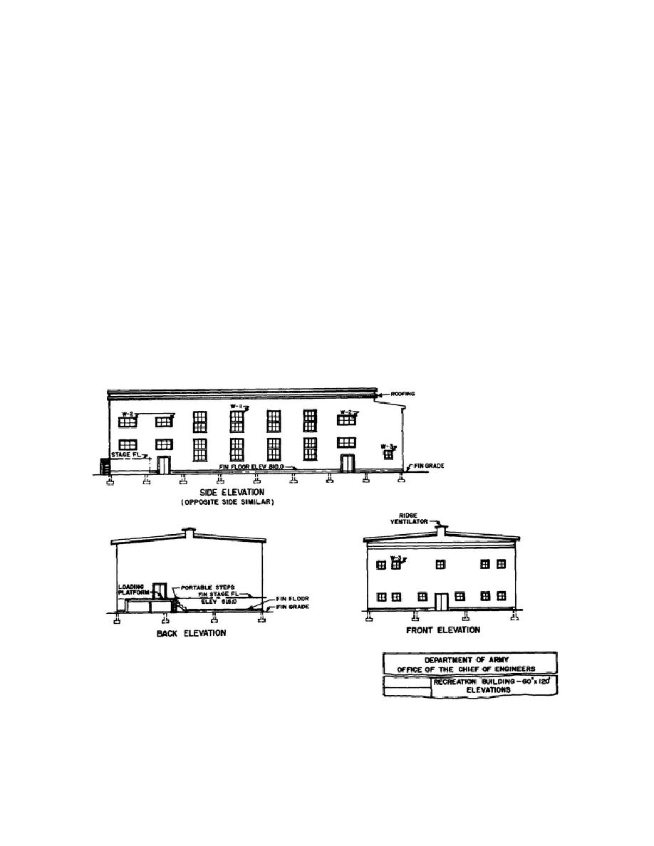
the front, rear, or side view of a building or structure.
facilities are given in the schedule of facilities.
Sample elevation views are presented in figure 2-4.
Materials of construction may be indicated on the
b. Examine the site plan shown in figure 2-3,
elevation. It may also show the ground level
and note the information you are able to obtain from
surrounding the structure, called the grade. When
it. For example, note how the contour lines and
more than one view is shown on a drawing sheet,
elevation notations show that the ground surface of
each view is identified by a title. If any view is
the site area slopes. See that the plan locates and
drawn to a scale different from that shown in the title
identifies each facility. Note that most of the
block, the scale is noted beneath the title of that view.
facilities are to be spaced apart by at least 60 feet,
while the library (facility No. 3) and the recreation
b. The centerline symbol of alternate long and
building (facility No. 4) must be only 15 feet apart.
short dashes in an elevation indicates finished floor
Observe that besides being the smallest of the four
lines. Foundations below grade are shown by the
buildings, the library is to be closest to the road; that
hidden line symbol of short, evenly spaced dashes.
is, the east wall of the library is 20 feet from the
Note in figure 2-4 that the footings are shown below
centerline of the road, whereas the other buildings are
grade.
30 or 60 feet from the centerline of the road.
c. Elevations show the locations and character
of doors and windows. Each different type window
shown in the elevations is marked (in figure 2-4, the
three types of
Figure 2-4 Elevation Views.
44


 Previous Page
