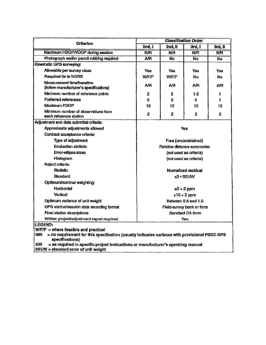
Table 5-3. GPS-S Design, Geometry, Connection, and Observing Criteria
(continued)
e. Location Feasibility and Field Reconnaissance. A good advance reconnaissance of all marks
within the project is crucial to the expedient and successful completion of a GPS-S. The site
reconnaissance should be completed before the survey is started. The surveyor should also prepare a
site sketch and a brief description on how to reach the point since the individual performing the site
reconnaissance may not be the same surveyor that returns to the station. The azimuths and vertical
angles should be determined using a compass and inclinometer and recorded by the individual
performing the site reconnaissance. Because obstructions such as trees and buildings cause the GPS
signal transmitted from the GPS satellite to be blocked, it is also important to know the type of
EN0593
5-18


 Previous Page
