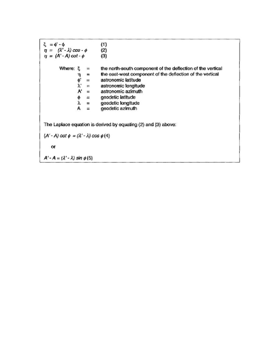
Table 1-2. Deviation of the Laplace Equation
(b) Refer to Table 1-2, and note that equations (1), (2), and (3) use the gravimetric method to
obtain the components of the deflection of the vertical (ξ and η). If the astronomical coordinates and
azimuth have been observed, the geodetic coordinates can be computed. The largest computed
difference in position between astronomic and geodetic observations is approximately 1,000 feet. The
average difference between the computed positions is somewhere in the neighborhood of 300 feet.
These differences in position look very small. However, we are looking for a precise position;
consequently, the geodesist must indicate the exact pinpoint position, not an approximation. This is
especially critical at the initial point of any weapons system since any deviation will influence the final
location of the impact area.
(c) The Laplace equation (5) in Table 1-2 is important because it gives the relationship
between the azimuth and longitude differences without knowing the components of the deflection of the
vertical. In survey networks this fundamental relationship is used as a check to determine the accuracy
of the observed geodetic and astronomic data.
(d) The astro-geodetic deflections of the vertical are only relative since the deflections of the
vertical are computed with respect to a specific ellipsoid. If the ellipsoid is changed, the deflections of
the vertical also change (Figure 1-17). It is necessary to assume a specific orientation of the reference
ellipsoid with respect to the geoid before computing the astro-geodetic deflections. This orientation is
fixed by the initial values of the datum point from which the geodetic coordinates were computed. Any
change in these initial values, therefore, changes the deflection of the vertical at each point.
Consequently, the astro-geodetic deflections of the vertical have the same restrictions as the geodetic
positions. They are related to the geodetic datum.
1-27
EN0593


 Previous Page
