following general methods or a combination. In the first method, which can be used in hilly or
mountainous country, test the intervisibility of the stations by visiting each one. If the stations are not
intervisible from the ground, clear obstructions on the line (such as trees) or adjust the tower heights to
allow intervisibility from either or both ends of the line. Find the elevations of intervening high points
by lowering a weighted tape from a helicopter or by using barometric or trigonometric leveling. In the
second method, obtain the elevations of the stations and the intervening country from maps or other
sources, and determine the intervisibility of points and the required heights of towers from the data. In
actual practice, a combination of the two methods is generally used. The reconnaissance party should
keep a total tower height for any one line to a minimum. Determining the instrument and signal heights
is a matter of good judgment, trial computations, and experience.
a. The difference between the apparent and the true difference in elevation of two points is affected
by two factors--the curvature of the earth's surface and the refraction of light by the earth's atmosphere.
Because of the earth's curvature, distant points appear to fall below a level line of sight from the point of
observation. Vertical refraction causes the line of sight to curve downward and makes the distant point
appear higher than its true elevation.
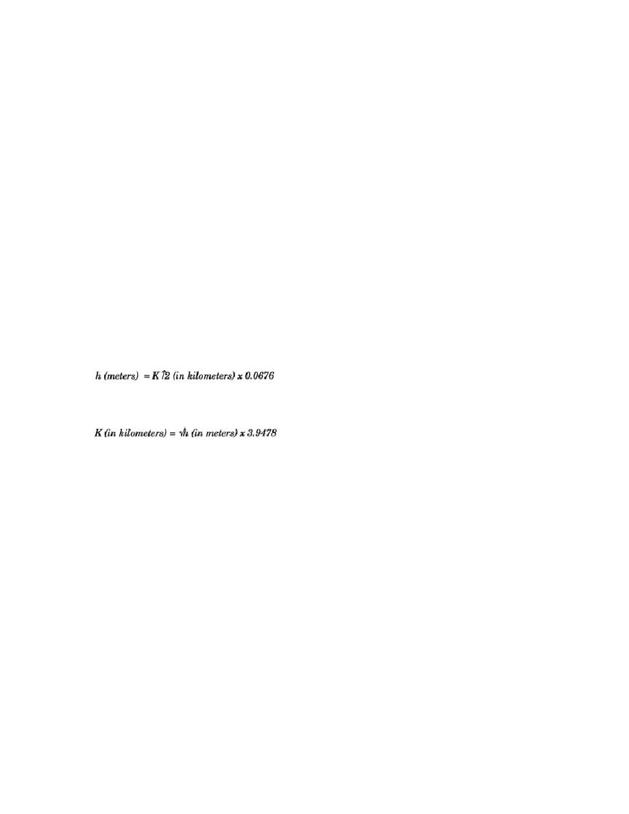
b. The effect of refraction is about one eighth as much as the curvature and opposite in sign (refer
to Table 2-1). In survey work, the two are combined and the approximate resultant correction is given
by the following formula:
Where h is the known quantity, the formula is:
Table 2-1 gives the corresponding values of K and h.
EN0593
2-30


 Previous Page
