1-8.
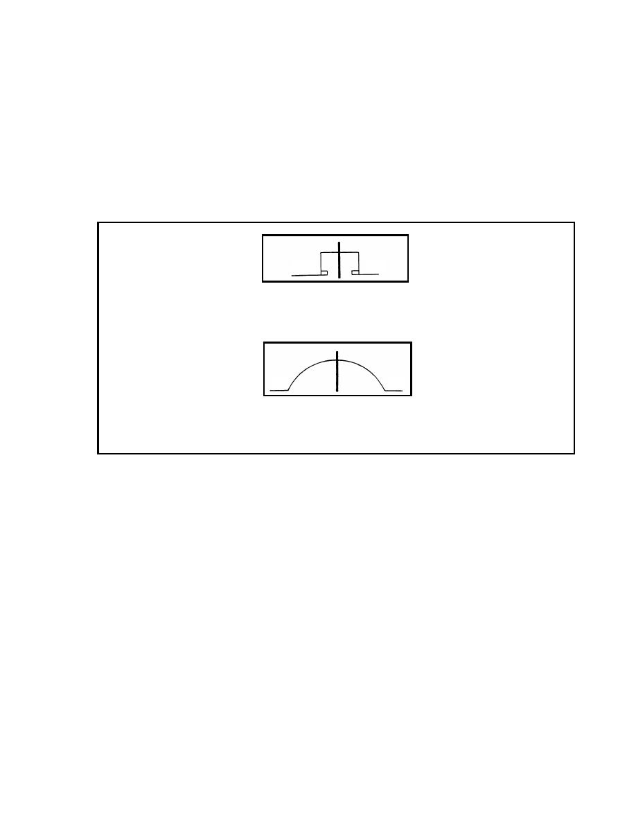
Underpass Symbol. This symbol is drawn so that it shows the actual shape of the
underpass. Sidewalks are drawn if applicable. The underpass is considered an obstruction if
the overhead clearance is less than 4.3 meters or when the traveled way is less than the
standards shown in Table 1-1. The overhead clearance or the traveled-way width will be
underlined if either is an obstruction. The width of the traveled way is written on the far
left side of the symbol. If sidewalks are present, the traveled-way width is followed by a
slash and then the total width is given. On the right side of the symbol, the overhead
clearance will be shown. If there is a minimum and maximum overhead clearance, both will
be given (Figure 1-7). In structures with arched ceilings, an extension of the width does not
necessarily mean the structures will accommodate wider vehicles. The underpass symbol
will be drawn so that the symbol intersects the route at the point of its geographic location.
6
8/10
Underpass With Sidewalks
(traveled-way width 8 m, total width
with sidewalks 10 m, and overhead clearance 6 m)
8
6/8
Arch Construction
(traveled-way width 8 m, overhead
clearance 6 m minimum and 8 m maximum)
Figure 1-7. Underpass Symbols
1-9.
Slope Symbol. Most vehicles that must negotiate slopes (also referred to as grades)
of 7 percent or greater for any significant distance will be slowed down. Route
reconnaissance is required to locate such obstructions to traffic flow and to accurately
report slope characteristics. Reconnaissance symbols have been adopted to portray the
gradient (percent of slopes) on maps and overlays (STANAG 2253).
a.
A single arrowhead along the trace of a route, pointing in the uphill direction,
indicates a slope of 5 percent or greater but less than 7 percent. Two arrowheads represent
a slope of 7 percent or greater but less than 10 percent. Three arrowheads represent a slope
of 10 percent or greater but less than 14 percent. Four arrowheads represent any slope that
is 14 percent or greater (Figure 1-8, page 1-6).
b.
The actual percent of slope is written to the right or to the left of the symbol.
Whenever the scale of the map permits, the length of the arrow will be drawn to scale to
represent the length of the slope. Slopes of 7 percent or greater are obstructions to traffic
flow and are indicated by the abbreviation OB in the route classification formula.
1-5
EN 5621


 Previous Page
