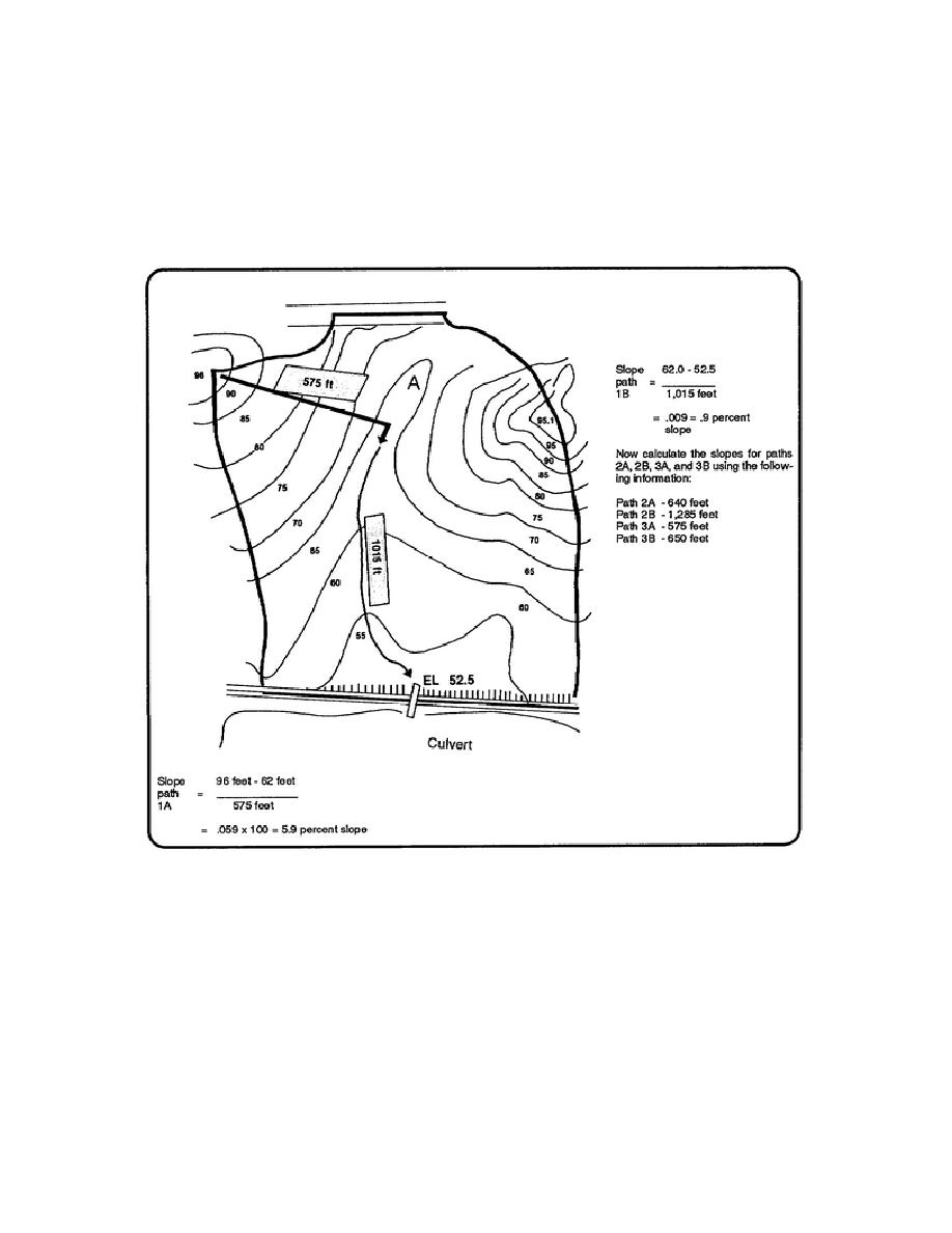
Refer to figure 2-4. Notice that our delineated area can be broken down into two sections. On the west side there
is a hill with an elevation of 96.0 feet. On the east side there is a much larger hill with an elevation of 95.1 feet.
The basin is divided by a north/south running swale. Notice also that the side on the eastern hill has a swale (see
"A" on figure 2-4) dividing the hill into two segments. This suggests that we can represent the water basin with
three representative flow paths. One path on the western hill and two paths on the eastern hill. If we draw a flow
path starting at the western hill top midway between the delineated lines, we could represent most of the flank of
the western hill (see arrow). Water moving down the hill would eventually gather in the swale turn south
(downhill) to the culvert.
Figure 2-4. Representative flow path 1
NOTE: The flow path for path 1 (see figure 2-4) will be drawn as far to the north as possible. Notice that the
flow arrows indicate a change in direction, meaning that the water would turn on the north side of the ridge,
outside of the delineated area, thereby contributing runoff to another watershed.
EN5465
2-10


 Previous Page
