STEP 2. Delineate subareas by soil and cover type. Since the type of cover has an effect on the coefficient of
runoff the watershed must be segmented according to its respective cover type. This information can usually be
obtained from the topographic map of the area. If available, a soils map can also be used.
STEP 3. Determine the acreage for each basin and subarea. This can be done using the Stripper Method that was
outlined in Lesson 1, Part B.
STEP 4. Classify the basin as simple or complex.
Simple Area -- One soil or cover type makes up 80 percent or more of the total basin.
Complex Area -- No one cover makes up 80 percent of the total area in the basin.
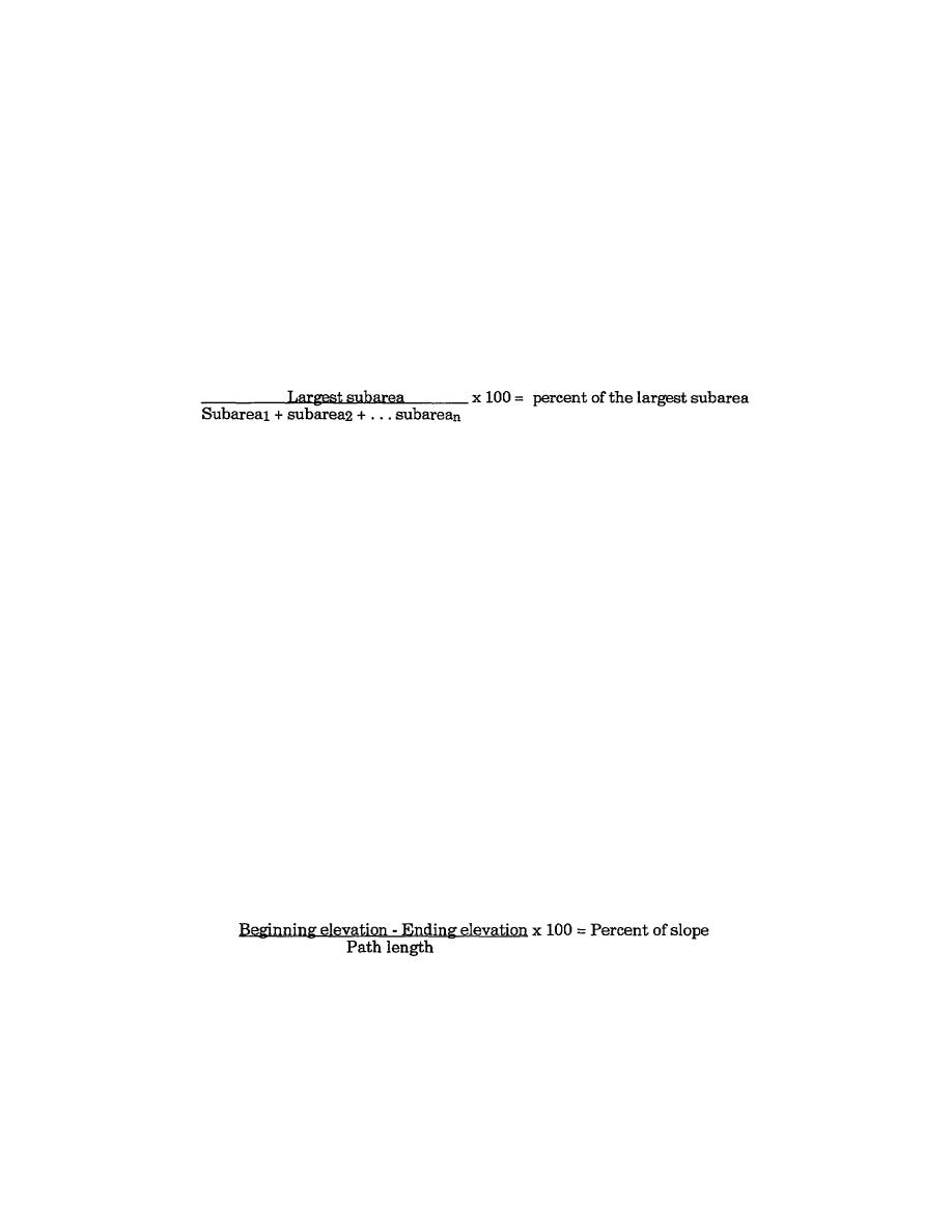
The simple formula can be used to calculate simple or complex areas:
STEP 5. Determine representative flow paths. Picking the representative flow paths is the most complex part of
the Rational Method procedure. In this process you will have to use sound engineering judgment. Representative
flow paths will be used in two separate processes and will affect two different variables in the Rational Method
equation.
a. Representative flow paths will be used to account for the time it takes water to flow across the ground
and reach the outlet. This process will be used to obtain the TOC. The TOC will then be used to adjust the
rainfall intensity by using the standard intensity curve in figure 1-5 on page 1-9. Procedures for obtaining the
TOC will be discussed in Lesson 2, Part B.
b. Representative flow paths will also be used to represent the average slope in the area. This procedure
will be outlined in Lesson 2, Step 5, page 2-9.
STEP 6. Divide the flow paths into two sections--sheet and channel flow. This step will be needed in order to
account for the time it will take water to move across the watershed. Sheet flow is slower than water flowing in a
ditch, so you will have to calculate their respective times differently. These procedures will be discussed in
Lesson 2, Part B.
STEP 7. Determine the slope of each section of the flow path. Since slope affects the speed at which water
moves across the basin and thus affects the runoff coefficient, you must calculate the slope of each path. This
information will be needed when using the sheet flow graphs and the ditch flow tables in Lesson 2, Part B. The
slope of each path can be calculated from information provided by the topographic map representing the
delineated basin. Use the following calculation:
STEP 8. Determine the average slope of the area. Every cover type within the basin will have a coefficient of
runoff. This coefficient will have to be adjusted according to the average slope of the terrain in that respective
area. This adjustment is accomplished using a coefficient table that has been figured with three different slope
ranges and their corresponding "C" values. (This will be covered in Lesson 2, Step 8, page 2-12.)
2-5
EN5465


 Previous Page
