NOTE: Sheet flow will transition to ditch flow at about 500 feet (+ -200 feet). Although this would vary with
slope and cover type.
STEP 7. Determine the slope of each section of each flow path. Since slope affects the velocity of water in the
paths, the slope of each path must be calculated. This can be done by using the contour lines. Path 1a starts on
the hill at the elevation of 96.0 feet. The path ends in the middle of the swale at 62.0 feet. The slope can be
calculated using the slope equation. See figure 2-4, page 2-10 and Step 7, page 2-5.
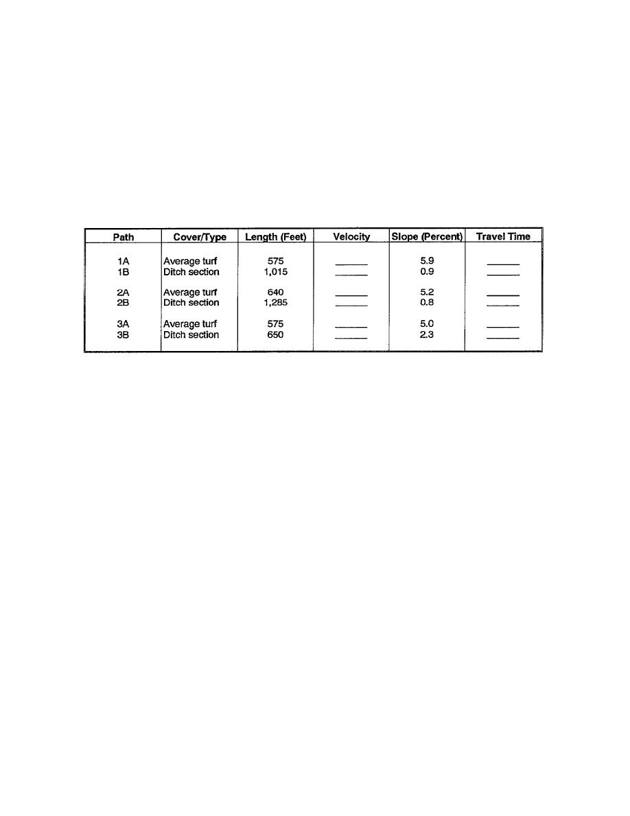
Now that all of the slopes have been calculated, it's a good idea to tabulate the data. The following format shown
in table 2-3 is suggested:
Table 2-3. Basin flow paths
NOTE: This format will be used throughout the lesson.
Refer to figure 2-5.
STEP 8. Determine the average slope of the basin or subareas. The slope of the paths will have an effect on the
basin and likewise on the "C" value. Because of this, if there is more than one flow path in the basin or each
subarea, we will have to get an average slope of the entire basin or each respective subarea. This is the second
process in which representative flow paths will be used.
Refer to figure 2-6. We'll start with path 1. Notice that path 1B runs downhill to the culvert in the same swale as
path 2B. Path 1B is redundant. It provides the same information as path 2B. For this reason, we will eliminate it
from the average for path 1. Now path 1 will have a path average of 5.9 percent (the former path 1A).
EN5465
2-12


 Previous Page
