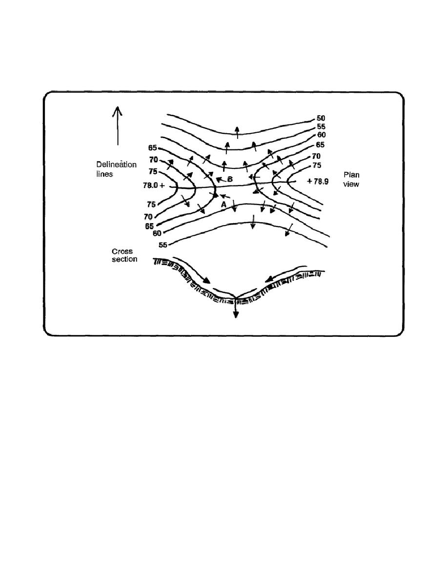
Figure 1-8 shows the delineation of a saddle. Notice that the flow arrows show a divergence of water on spurs.
The delineation line is drawn between the opposing arrows (see A and B). The cross section of the swale
represents the actual converging point for water that will be contributed to the southern half of the delineated
saddle.
Figure 1-8. Delineation of a saddle
Most delineated boundaries will be adjacent to roadways. Because most roads on level ground use crowned
profiles for road surface drainage, the delineated boundary would be marked down the center of the road. This is
illustrated by the flow arrows in figure 1-9, which shows a delineated drainage basin for an airfield project
EN5465
1-12


 Previous Page
